DIONE Earth Observation Component
Aims to harness DIAS/Sentinel Hub to support data management and processing of EO data, area monitoring markers, drones, data fusion, and super resolution techniques towards the provision of enhance resolution maps of permanent pastures, crop-types, non-productive Ecological Focus Areas (EFA) types and farmers’ activities (i.e. grassland mowing/ploughing, etc.)
1. Area monitoring markers
DIONE area monitoring markers service includes a set of image analysis and machine learning techniques, made available via a REST API, which utilise Sentinel signals towards the identification of various crop types, land types (including permanent pastures and Ecological Focus Areas) as well as the detection of agricultural activity (mowing, ploughing, harvesting) at several times during the growing season.
The current version of the service includes the following markers:
- Homogeneity - used to determine if a parcel geometry really consists of a single crop or if there are multiple things growing on the parcel
- Similarity and distance scores- used to give additional context to the crop classification and to detect erroneous claims
- Bare soil marker - used to detect observation where bare soil is present on the feature of interest. This indicates agricultural activity on the feature of interest (plowing, harvest)
- Mowing marker - used to detect mowing events on meadow/grass like features of interest
- Crop marker - used to detect the specific crop growing on the feature of interest
- Land marker - used to detect the land type and non-productive EFAs of the feature of interest
- Mean NDVI marker - used to detect erroneous claims with no vegetation
The tool exploits DIAS’ storage of Copernicus data in its fullness, through the usage of Sentinel Hub which is operational on 3 out of 4 DIAS-es, making use of not just the data but also DIAS provided services such as data catalogue.
Last but not least, the system is designed and implemented in a cloud agnostic manner, exploiting the capabilities of the selected cloud while ensuring through the provision of alternative options, that there is no hard dependency on a specific cloud.
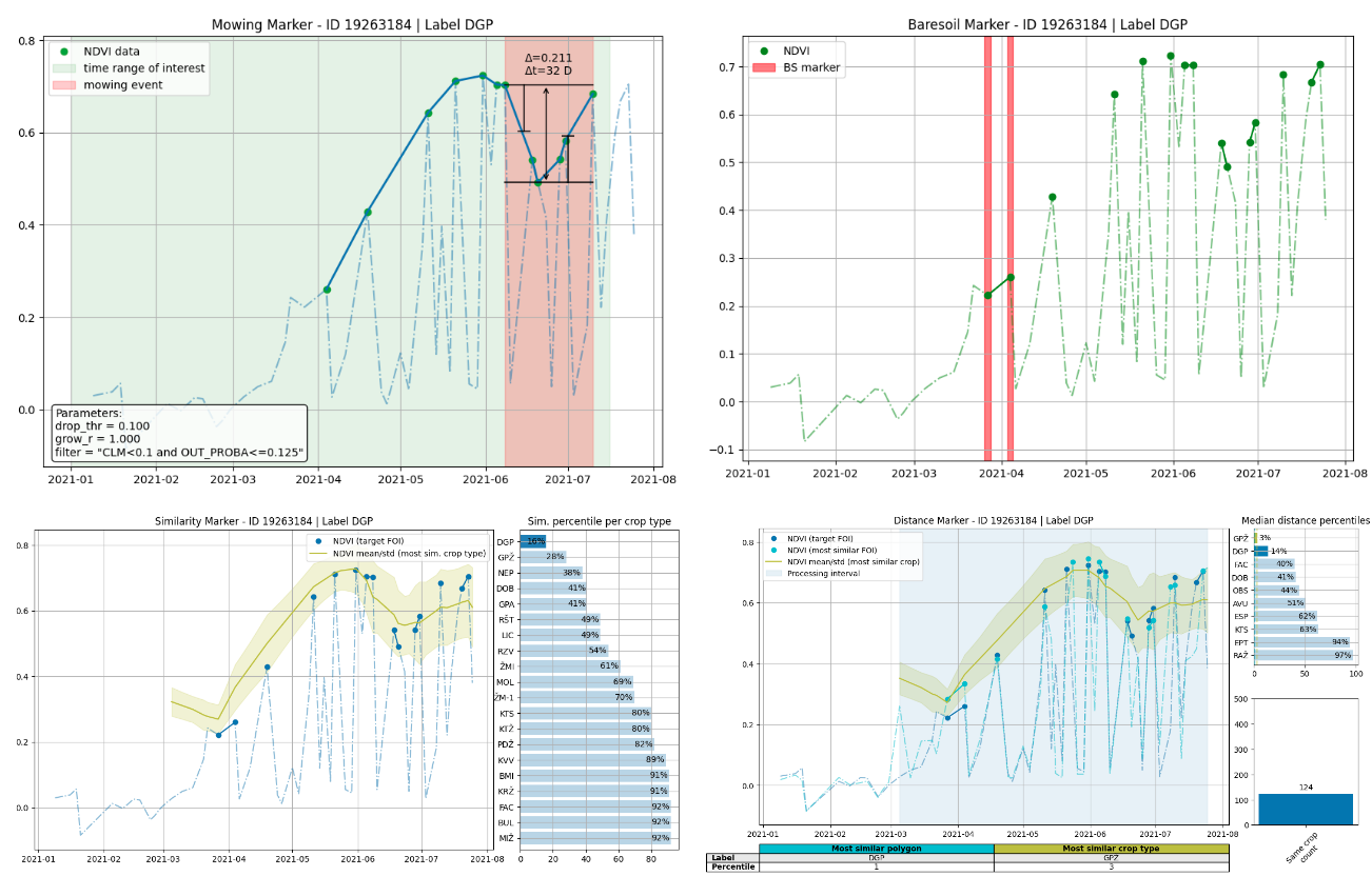
Earth Observation (EO) Markers
2. Drone platform
The drone/UAV platform represents a combination of hardware and software tools that are employed towards the conduction of drone flights in targeted areas of interest (i.e. regions of small, narrow and elongated land parcels and/or areas with significant cloud cover). The system can efficiently support end-to-end operations ranging from mapping control and flight planning to data processing and management.
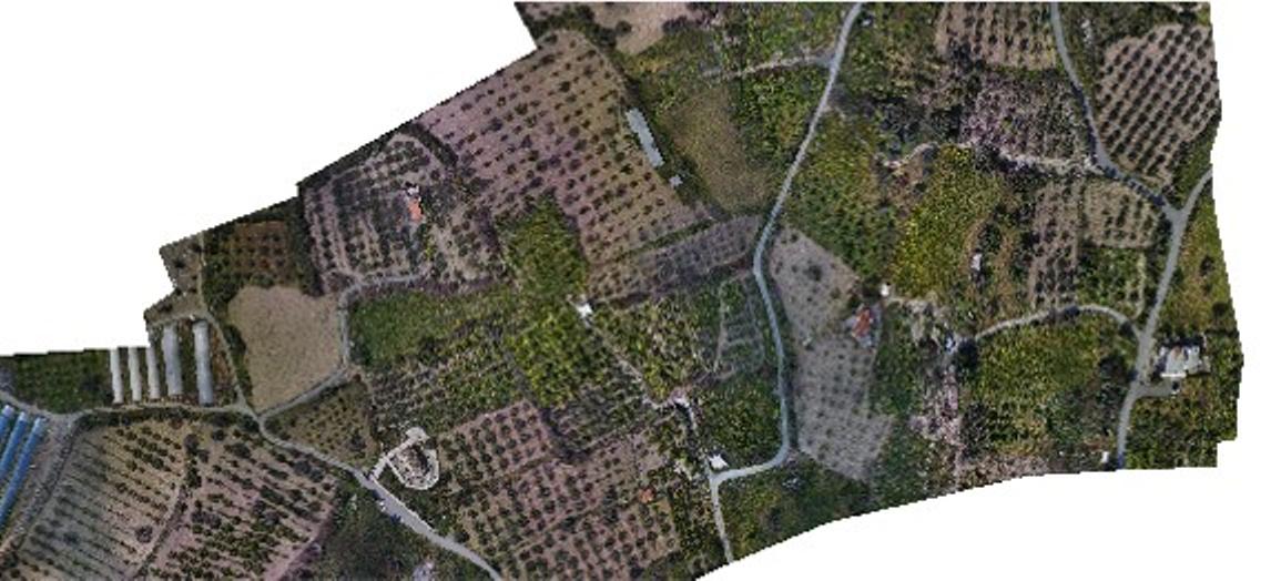
Drone Platform Orthomosaic
3. Super resolution by fusing Sentinel-2 and VHR/drone data for CAP parameters monitoring
It involves the implementation of machine learning and data fusion algorithms that support the extraction of useful information from highly variable inputs. This will further allow the distinction of landscape features, which would otherwise not be available in Sentinel 2 data.
The use of VHR data (Copernicus Contributing Missions) in combination with drone imagery will enhance the super-resolution modelling capabilities, enabling the augmentation of the training dataset (spatio-temporal scale) and subsequently leading to increased model performance.
The goal is to enhance the outputs of the area monitoring markers, and especially in the monitoring of small (i.e. 100m2), narrow and elongated parcels.
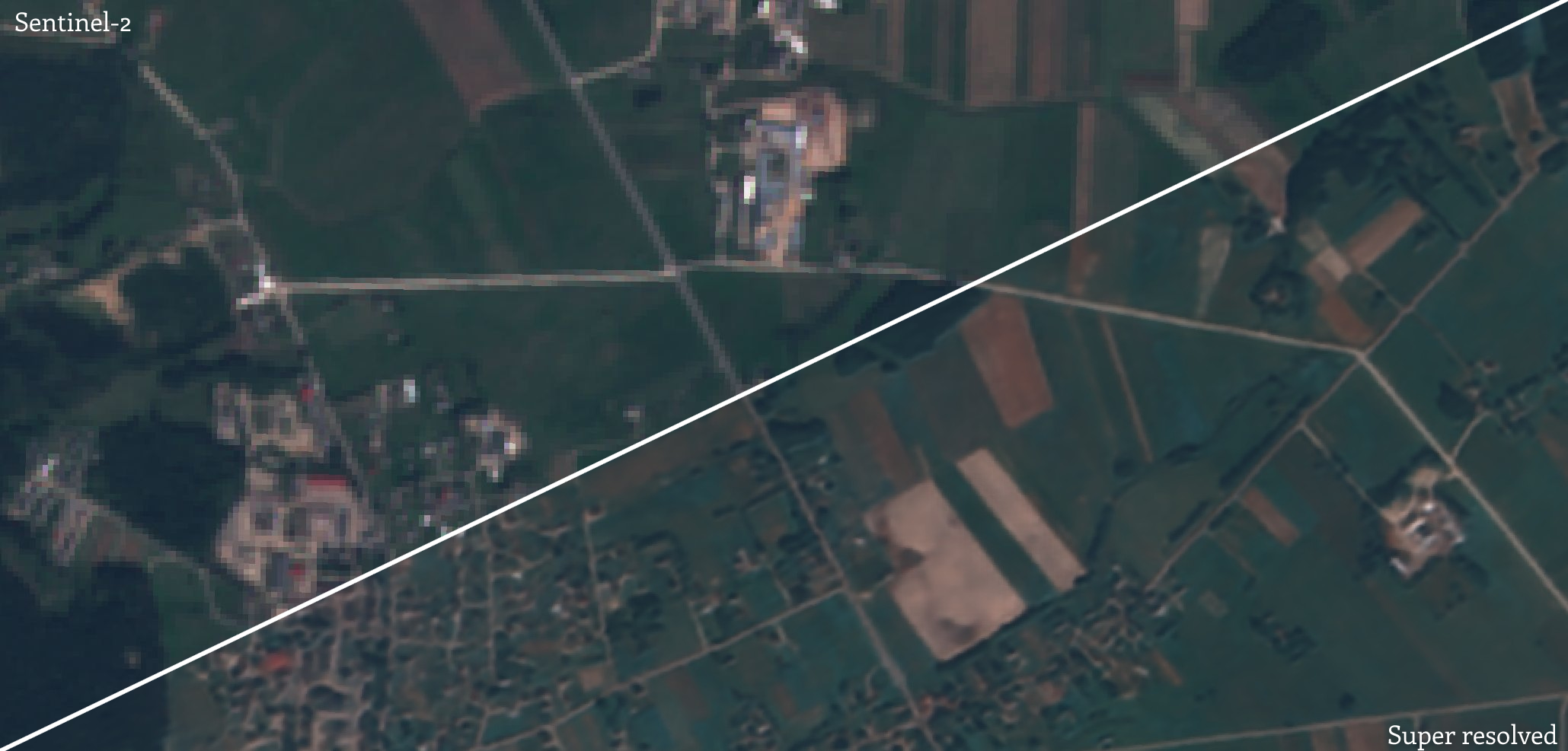
Super Resolution Tool
4. Spatial augmentation of Sentinel 2 coarser resolution bands
It is a software tool that consists of deep learning network architectures that enable the augmentation of the coarser resolution bands of Sentinel 2 bands (20, 60m) to the resolution of the finer bands (10m).
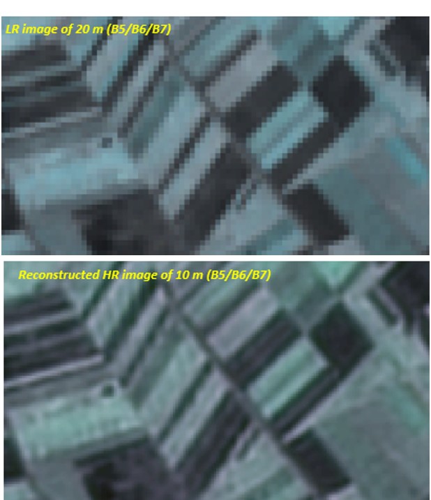
Spatial augmentation of Sentinel 2
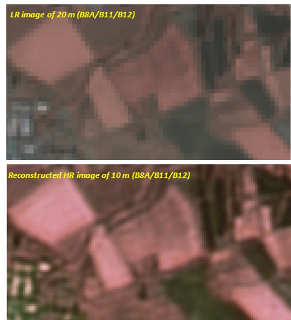
Spatial augmentation of Sentinel 2